
Understanding the layout of Olympic National Park
Overview of Olympic National Park
Olympic National Park, located in Washington State, is a marvel in the Pacific Northwest that's been drawing adventurers with its vast and diverse range of ecosystems. Over 922,000 acres await exploration, and having a reliable Olympic National Park map can turn a good trip into a great one. It’s so extensive; you get everything from wild coastline to temperate rainforests, and even glacial peaks.
The park is divided into four key areas: the rugged Pacific coastline, the lush temperate forest, the alpine regions, and the drier eastern side. It's worthwhile noting that 95% of the park's territory is designated wilderness, offering plenty of trails for hiking enthusiasts. The park also contains several notable landmarks such as Hurricane Ridge, Lake Crescent, and the Hoh Rain Forest.
Why you need a map
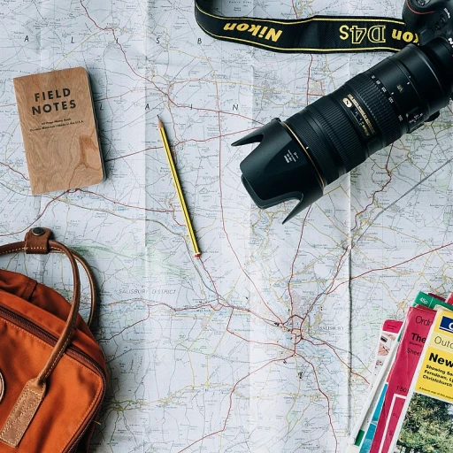
Exploring such a diverse park like this without a proper map can be a bit like diving headfirst without testing the waters. Paper maps, as well as digital ones from outfits like National Geographic, provide reliable, detailed trails that apps might not cover. Online reviews often favor National Geographic maps for their accuracy and durability.
Custom maps can tailor your journey, especially if you have specific spots like Sol Duc Hot Springs or Enchanted Valley in mind. Popular trails, as indicated on these maps, include the Rialto Beach for breathtaking coastal views and the challenging trek up Mount Olympus.
Park amenities and more
One often overlooked aspect is the variety of amenities within the park. From cabins like Log Cabin Resort by Lake Crescent to luxurious stays at Quinault Lodge, there’s something for every budget. The Park Service also does an incredible job keeping facilities like bathrooms in good condition. Always check updated current conditions and forecasts provided by the National Park Service to stay safe and prepared.
Imagine renting a water toy at Lake Crescent or having a peaceful retreat at Lake Quinault Lodge. For those looking to avoid the crowds, hitting the trails early or in the off-season can be beneficial. Always pack a map to ensure you can find those quieter spots.
Top hiking trails to explore
The best hiking trails in Olympic National Park to plan your next adventure
Hurricane Ridge
Hurricane Ridge offers some of the most stunning vistas in the Olympic National Park. With more than 600,000 acres of wilderness, the park map will be your best friend here. Hurricane Ridge is especially popular for its panoramic views of the Olympic Peninsula. Don't forget to hike the Hurricane Hill trail, which is around 3 miles round trip and perfect for all skill levels. According to the National Park Service, the trail also provides access to breathtaking wildflower meadows.
Sol Duc Hot Springs Area
The Sol Duc area is a hidden gem that many visitors rave about in their reviews. The Sol Duc Falls Trail is a must-see and relatively short, only about 1.6 miles round-trip, leading you through lush old-growth forests to a beautiful waterfall. For those looking for more of a challenge, the Seven Lakes Basin offers a 12.7-mile loop with stunning alpine views. Higher elevations in this area can be snowy even in the summer, so always check the current conditions updated on the National Park Service website.
Lake Crescent Trails
Lake Crescent Lodge area offers both easy and more strenuous hikes. The Marymere Falls Trail is an easy, family-friendly 1.8-mile trail leading to a mesmerizing waterfall. For a more challenging hike, the Mt. Storm King trail is a heart-pounding ascent with sweeping views of Lake Crescent. Don't forget a map! Printed versions can often be found at the Lake Crescent Lodge visitor center.
Rialto Beach and the Coastal Hikes
If you love ocean vistas, the Olympic coast offers incredible beach hiking. Rialto Beach is known for its dramatic sea stacks and tide pools. From the beach, hike to the Hole-in-the-Wall, a natural arch formation about 3.3 miles round trip. Keep an eye on the tide schedule; getting caught by rising water can be dangerous. The National Park Service provides updated current conditions to help you plan better.
Quinault Rain Forest and the Enchanted Valley
The Quinault Rain Forest is a heavily wooded area known for its immense old-growth trees and lush underbrush. The Enchanted Valley hike is one of Olympic National Park's most enchanting trails. The 13-mile trail leads you deep into the forest, where you'll encounter waterfalls and a rich variety of flora and fauna. USGS maps of the Olympic National Forest can provide detailed topographical information to enhance your adventure.
Remember, each trail offers unique experiences. Using custom maps from sources like National Geographic trail maps can add to your adventure by highlighting less-known trails and scenic spots. And always read trail reviews for personal insights and hidden gems along the way!
Navigating with custom maps
Using custom maps for your Olympic adventure
When you venture into the Olympic National Park, you want to make sure you're set with the right navigation tools. It goes beyond just having a paper map or a national geographic map in your pack. Custom maps can add a whole new dimension to your hiking experience. Sometimes, the standard maps don’t cover all the details you need for specific trails or off-the-beaten-path hikes. That’s where custom maps come into play. You can create personalized maps that highlight must-see locations like Lake Crescent, Hurricane Ridge, Sol Duc Hot Springs, and even the lesser-known Enchanted Valley. Use tools like GIS software or custom mapping services to pinpoint your exact route and stops. For instance, if you're hiking the Seven Lakes Basin, a custom map that shows the elevation gains and nearby water sources can be invaluable. I remember my hike there – the map I had didn’t show a crucial detour near Log Cabin Resort, and I ended up adding three extra miles to my trek to find it! Aside from the added features, custom maps also mean you can include updated current conditions and forecast updates from trusted sources like the National Park Service and USGS. This is especially handy when tracking weather changes in areas like Hill Hurricane or during water toy rentals at Lake Quinault Lodge. Trust me, nothing's worse than being caught in the rain unprepared. There are even online platforms that let you save and share your custom maps. Platforms like AllTrails or Gaia GPS allow for reviews and updates from fellow hikers, ensuring you have the latest insights and potential hazards marked. It’s almost like having a hiking buddy who’s already been through the trail and annotated their map with all the hot tips. Don't forget to accommodate geographical factors. The Olympic National Forest spans diverse ecosystems, from the lush Hoh River rainforest to the coastal stretches of Rialto Beach. A one-size-fits-all map might miss specific trail conditions. For example, a custom map tailored for Mount Olympus will require different markers for glaciers compared to a map for the lower elevation trails. With this level of customization, your hike in Olympic National Park will be smoother and more enjoyable. Whether you're setting out from Port Angeles or chasing the sunsets at Pacific Northwest’s Olympic Coast, custom maps can make all the difference. So next time you plan your trip, go beyond the paper and explore the digital custom mapping options. Your adventures will thank you.Exploring the diverse ecosystems
Diverse ecosystems await
Olympic National Park is not just a place; it’s an experience through a wide array of ecosystems all within a reasonably short distance. From the rugged coastline to lush rainforests and alpine meadows, the diversity of landscapes is breathtaking. For hikers, this means a different adventure on almost every trail.
Take for instance the lush Hoh Rain Forest, an area that sees over 140 inches of rain annually (National Park Service). Moss-draped trees and lush greenery create a serene landscape that feels like stepping into another world. The Hoh River Trail is a popular hike that leads into the heart of this temperate rainforest, offering a 34-mile round trip for those seeking a deeper experience (National Geographic).
Then there’s the rugged Olympic Coast, with its tide pools, sea stacks, and miles of beaches. Rialto Beach, one of the most accessible spots, gives a dramatic showcase of this coastal ecosystem. It's also close to the famous Hole-in-the-Wall rock formation, a well-known feature among locals and tourists alike (U.S. Geological Survey).
Elevating your hike, the sub-alpine and alpine regions, like those around Hurricane Ridge, offer completely different views. In the summer, meadows bloom with wildflowers, while on a clear day, you might spot Mount Olympus, the tallest peak in the park at 7,980 feet (National Park Service).
Lake Crescent is another gem, and its crystal-clear waters are perfect for kayaking or a refreshing swim after a hike. The nearby Marymere Falls Trail is an easy 1.8-mile round trip, making it ideal for families (National Park Washington). The Quinault Rain Forest, with its giant Sitka spruce and the charming Lake Quinault Lodge, offers both history and natural beauty. This area is also a starting point for hikes into the Enchanted Valley, known for its stunning waterfalls and wildlife sightings.
Each of these ecosystems not only contributes to the park's beauty but also its diversity of flora and fauna. Whether finding peace in the solitude of the forest, standing in awe of the coastal cliffs, or marveling at the panoramic views from the ridgelines, you’re guaranteed a memorable experience. According to a 2020 visitor survey, 87% of hikers reported high satisfaction with the variety and beauty of the park’s landscapes (National Park Service)
Tips for a successful hiking trip
Plan Your Gear Wisely for Various Weather Conditions
When it comes to hiking in Olympic National Park, checking the current conditions updated before hitting the trail is crucial. The weather here can be unpredictable. From rain in the Olympic National Forest to windy chills at Hurricane Ridge, preparing for different conditions can make or break your hike.
First, grab yourself a reliable Olympic National Park map. The National Geographic Maps are often highly rated for their detail and accuracy. With a map of Olympic, you can plan your route and identify safe spots like Enchanted Valley or Sol Duc hot springs resort for a quick rest.
Stay Hydrated and Well-fed
Carrying enough water can't be stressed enough. There are water toy rentals and filtering options available, but bringing your own clean water is safer. Plan for high-energy snacks to replenish your energy while heading to spots like Lake Crescent lodge or Lake Quinault lodge.
Caressing Local Flora and Fauna
While exploring the rich ecosystems, it's important to respect the habitats of the Olympic National Forest. Stick to marked trails, like the ones leading to Rialto Beach or the Hoh River, to avoid disturbing the fragile environment.
When nature calls, make sure the areas you visit have bathrooms. Many places, especially less crowded spots like Log Cabin Resort or Quinault Lodge, usually have clean facilities.
Firsthand Tips from Fellow Hikers
I remember my first trek to the Hurricane Ridge. With forecasts updated frequently, having the full forecast updated allowed me to dress in layers, keeping me comfortable through the varying weather patterns.
Port Angeles is a great starting point; I easily rented gear with Mastercard and reached the trailhead of the Sol Duc hot springs trail, making it an unforgettable experience.
Personal stories and experiences
Unforgettable moments on the trail
As I wandered through Olympic National Park, one moment stands out vividly. Hiking the Sol Duc trail early one morning amidst towering trees and the sound of water rushing from Sol Duc Hot Springs, I encountered a family of deer. It was so serene, like nature's own welcome party. This is the heart of what makes exploring the park with a Olympic National Park map so essential, ensuring you don't miss out on such enchantment.
Connecting with fellow hikers
At one point during the trek up to Hurricane Ridge, I met a fellow hiker who had been visiting the park yearly for over a decade. He detailed experiences from Lake Crescent to the stunning vistas of the Seven Lakes Basin. His advice on carrying a National Geographic map for accurate details came in handy multiple times, especially when navigating towards the more secluded areas like Enchanted Valley.
Adapting to unexpected challenges
No hike goes without its surprises. On my trail to Mount Olympus, the weather turned unexpectedly foggy. Those updated current conditions predictions were crucial. The dimming light snuck up quickly and having my reliable paper maps in a waterproof cover saved me from veering off into unmarked paths. Reviews of various trails suggested this could happen, but experiencing it firsthand was eye-opening.
Why custom maps make a difference
When I explored Lake Quinault and stayed at the Quinault Lodge, the lodge's custom maps were a revelation. They highlighted lesser-known spots and cozy cabins such as the Log Cabin Resort, tucked away from the bustling trails of the Olympic Peninsula. Personalized maps custom to visitors’ needs can significantly enhance your visit.
Reviews that build community
Hiking along the Hoh River trail, I stayed at a rustic log cabin. Here, I unwound with other adventurers, sharing stories from our trails. It's in these moments that the hiking community truly shines. The detailed reviews and tips found on online forums were echoed in person, reinforcing their reliability and the sense of camaraderie among hikers dedicated to experiencing the beauty of the Olympic National Park, Washington.







-large-teaser.webp)